Back
South Park Patras
Year: 2022
Category: Landscape & Urbanism
Skills: Rhino, Illustrator, AutoCAD, Photoshop
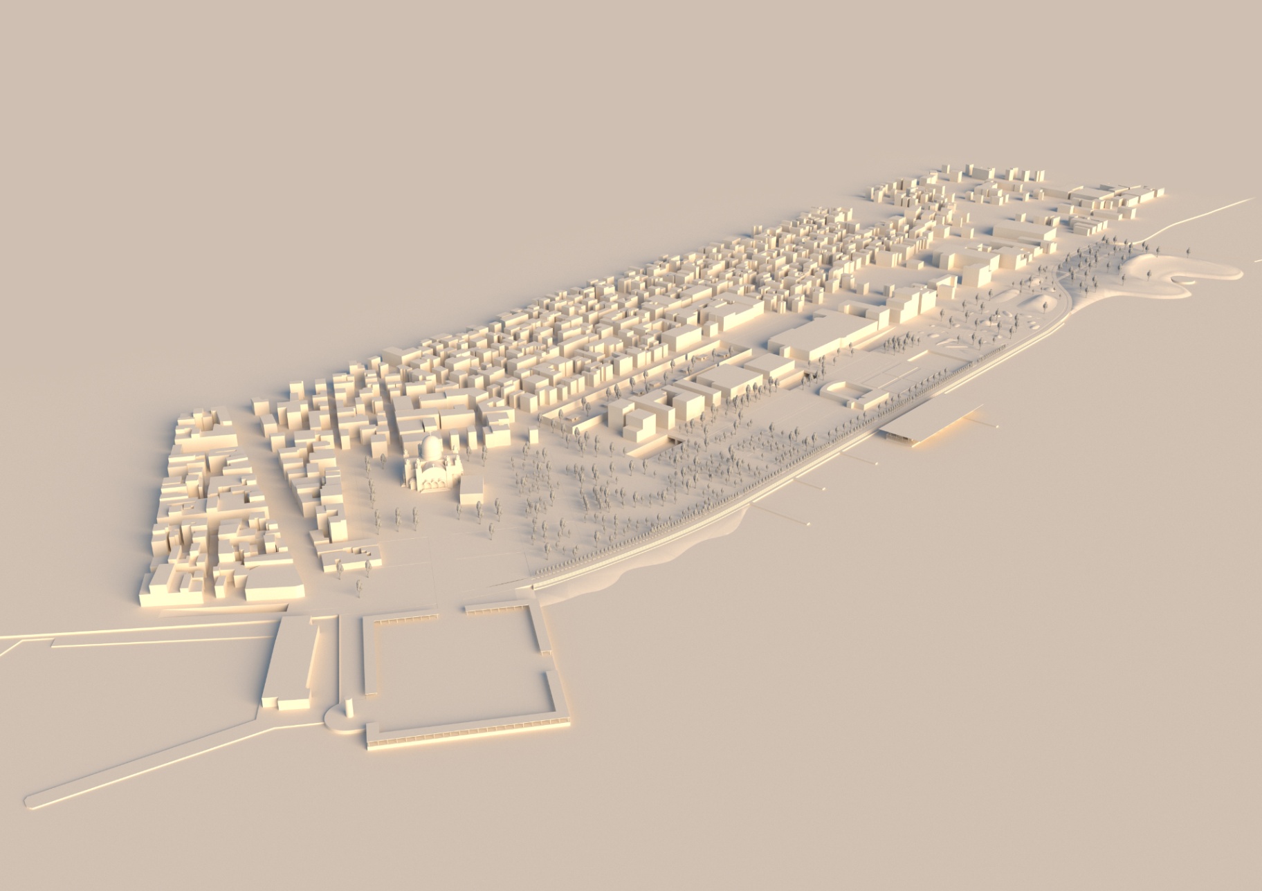
Observing the map, we identified the two canals, the original design of Voulgaris and the younger one. We extended these two canals until they reached the water. Thus, the relationship between the city and the sea is redefined as the seashore becomes the city's boundary. The two canals come into conflict with each other. By extending the canals, we continued the conflict to the water. Thus, we attempt to redefine the relationship between the city and the sea. We aim to restore the connection of the city with the sea. As the city's organization system flows into the seafront, the zones of our proposal are shaped based on it. The main traffic becomes straight along the water, connecting the lighthouse with the hill, changing the shape of the coastline. We have created a square, a counterweight of Agios Andreas, and we attempt to reinterpret the parish of the square along the water. The galleries delimit it and create visual escapes to the landscape. The atmosphere we want to create is the transfer of the urban square along the water. Following the city's organization system, a sports area is developed and the activities of the NOPA are strengthened. In the urban void that appears, thanks to the undergrounding of the road and railway line, we placed an enclosed garden with pavilions. For the needs of the NOPA, we designed a building on the water. In the enclosed garden, you follow a closed path, which leads you to the pavilions, which host temporary exhibitions. After the sports zone, there is a complex of hills with artificial mounds, which ends at the large hill. The hill is a point of relaxation, both of our proposal and of the entire coastal front of Patras. The hill is designed so that it can host various cultural events. At the same time, it also functions as a gathering and relaxation space. The geological protrusion of the hill is done in order to isolate it from the port and the section of the road that has not been undergrounded. Thanks to the undergrounding of Akti Dimaion, it is possible to extend the fabric to the water. The central coastal movement is divided into three lanes: the one directly along the water, the elevated one and the bicycle path. The basic design gestures are the extension of the canals, the redefinition of the square along the water and the coastal movement, connecting the lighthouse with the hill. Our proposal aims to restore the city's urban front along the water as a system of organization and to redefine its relationship with it.
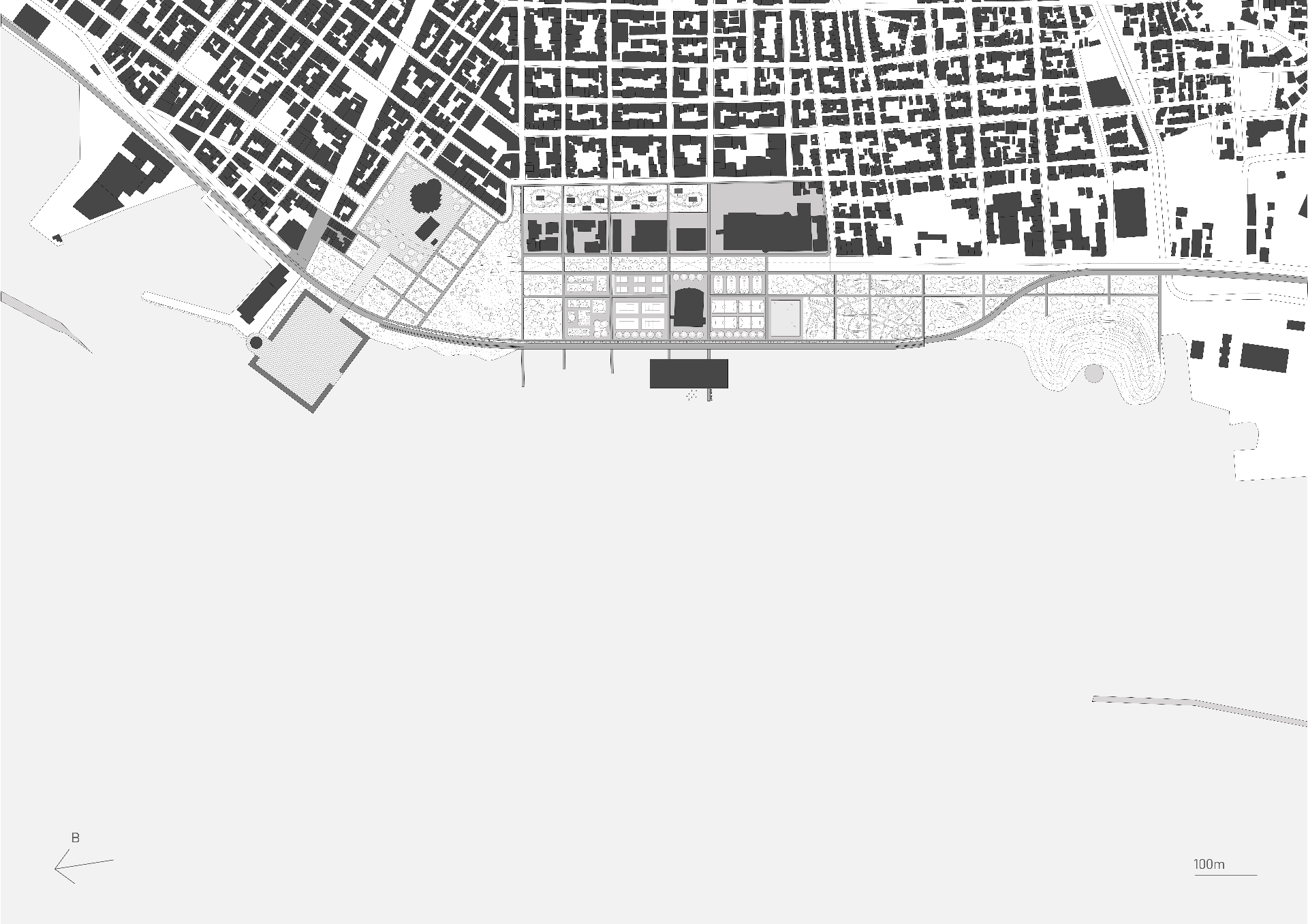
Masterplan
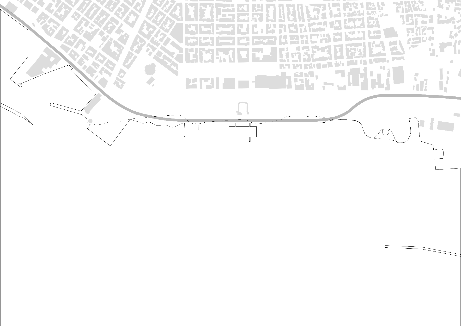
Before & After
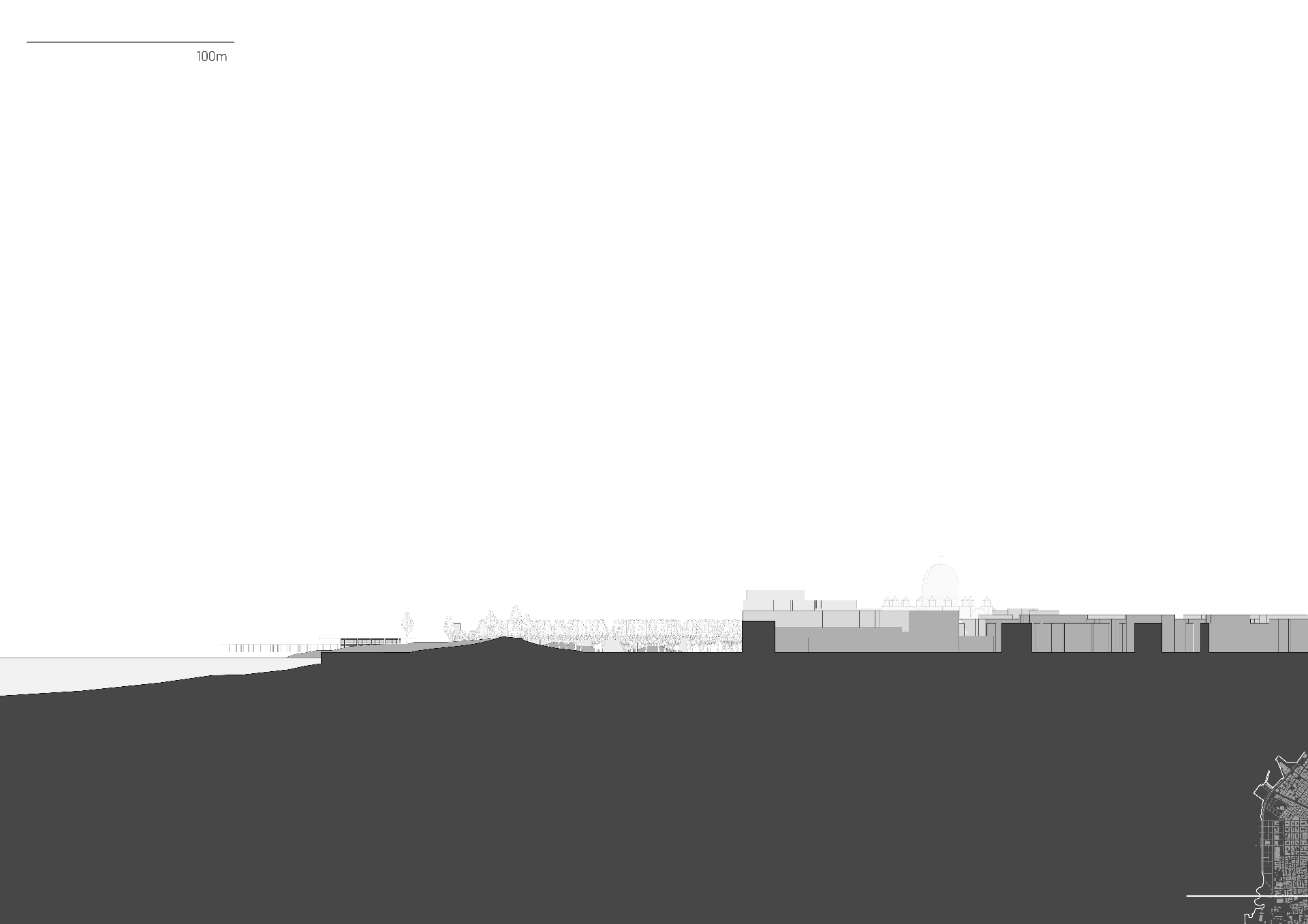
Hill Section

George Genovezos
More by George Genovezos
View profile